PLAY: Whaleback AnticlineThe Whaleback Anticline is a world-class geology field site in central Pennsylvania for the study of fold geometry, kinematics, and mechanics. This virtual field experience includes a Structure-from-Motion-captured model of the Bear Valley Strip Mine (Shamokin, Pennsylvania) that includes the Whaleback and several adjacent folds.
The virtual field experience is hosted on itch.io. Click here or on the image on the right to have the virtual field experience. Please wait 15-45 seconds for the game to load after starting it. We recommend using Google Chrome or Firefox to play. Troubleshooting: Turn off ad blockers to play |
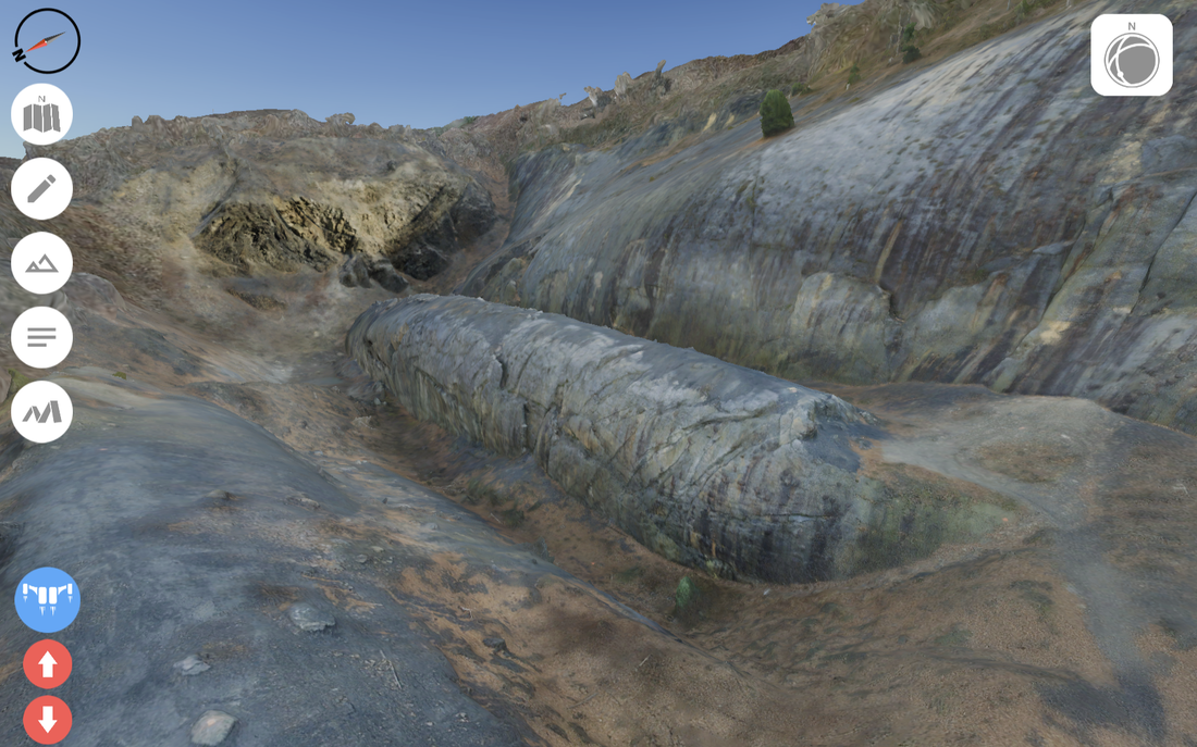
Click on image to go to itch.io site to have the virtual field experience
|
WATCH: Video tutorial on game playWe made a 10-min video describing how to use the tools within the virtual experience.
The video description on YouTube contains links to particular sections of the video. If you plan to use our Whaleback experience for education, please consider watching the tutorial video (watching at 1.5x speed is helpful); however, below are some quick-start directions if you just want to briefly explore. |
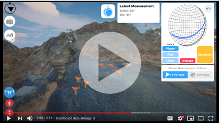
Click on image to open YouTube tutorial on gameplay
|
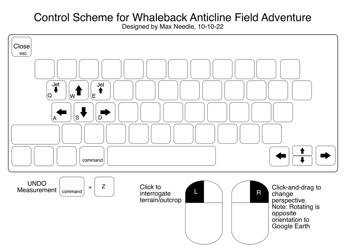
Quick Start Guide
|
Starting the Game:
|
|
Credits
Designers / Engineers
Primary Whaleback Research Collaborators
Photography at the Bear Valley Strip Mine / photogrammetry advising
Support for Whaleback model and/or game generation
- Mattathias "Max" Needle
- Jacky Mooc
- Andrew Wang
- John Akers
Primary Whaleback Research Collaborators
- Juliet G. Crider, Department of Earth & Space Sciences, University of Washington
- Mary Beth Gray, Department of Geology, Bucknell University
- Arlo B. Weil, Department of Geology, Bryn Mawr College
Photography at the Bear Valley Strip Mine / photogrammetry advising
- Keith Hodson
Support for Whaleback model and/or game generation
- NSF: EAR-1523909
- Reality Lab Incubator, U. of Washington
- Department of Earth and Space Sciences, U. of Washington
- Geological Society of America
- Student Technology Fee, U. of Washington
